
Integrated Navigation
Position, velocity and attitude from a unified navigation architecture.
Esima combines inertial measurements with GNSS through multi-sensor fusion, producing a single navigation solution for the platform.
Two measurement sources, one navigation state.
Different Rates, One State
IMU and GNSS measurements arrive at different update rates and with different characteristics. A common estimation framework brings them together into one navigation state.
GNSS-Aided Inertial Navigation
Inertial measurements are the continuous basis of the solution, providing high-rate acceleration and angular-rate information. GNSS provides the external reference the inertial solution is corrected against.
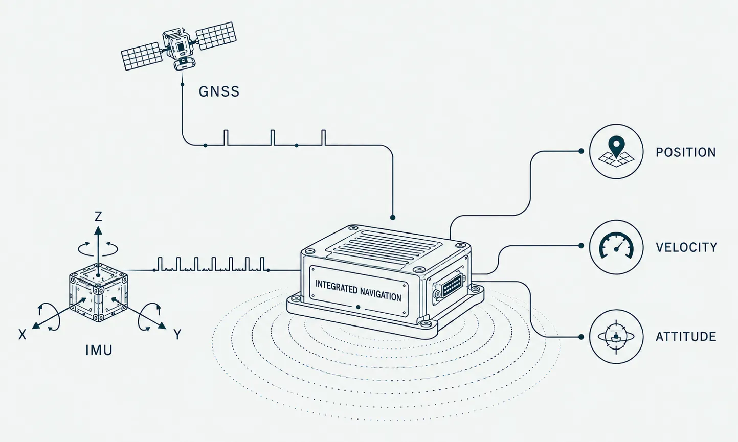
What the solution is built on.
GNSS
Satellite-based positioning, including RTK-capable configurations where required.
IMU
Accelerometers and gyroscopes measuring the platform's motion and rotation.
Sensor Fusion
The estimation layer that combines both measurement streams.
The sensor-fusion framework is designed to incorporate measurements from other sensing modalities, so the sensor set can grow without changing the core estimation approach.
One architecture, different platforms.
The modular structure is intended to accommodate different hardware and platform requirements without tying the navigation solution to a single implementation.
Sensor interfaces, estimation functions and navigation outputs remain separate parts of the architecture, providing a clear basis for system integration.
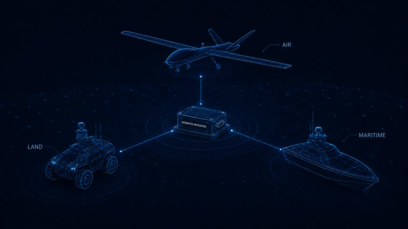
Air
Designed for integration with airborne platforms operating across changing flight conditions.
Land
Adaptable to ground platforms that require consistent navigation data across different motion profiles and operating environments.
Maritime
Applicable to maritime platforms, where vessel motion from waves and sea state is continuous.
Tell us about your requirements, and we can discuss how Integrated Navigation could fit.
Talk to Our Team